News
Diving into groundwater — what’s left of it
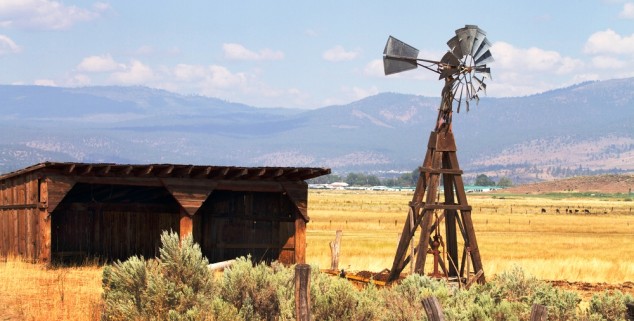 An old wind-driven pump that tapped groundwater on a California ranch. Photo: Steven Frame)
As the warm temperatures melt California’s meager snowpack, turning rivers into streams and streams into mere trickles, communities and farmers across the state will be increasingly turning to groundwater to meet customer demand and to keep crops and livestock alive.
But there’s a problem: Many will be drawing from aquifers already depleted and long under stress as groundwater levels in many basins across the state are at historic lows.
Groundwater is a critical component of the California’s overall water supply, providing 40% of the state’s water in average years and up to 60% or more in dry ones. Some communities rely solely on groundwater, some only on surface water, and others on a combination of both. Additionally, millions of rural residents rely on domestic wells for their homes. Overall, about 85% of all Californians rely on groundwater for at least a portion of their water supply.
Over the years, California’s communities, farmers, and rural residents have turned to groundwater as surface water becomes less available, and they’ve been taking more from the basins than nature replenishes.
The state’s Department of Water Resources estimates that 1 to 2 million acre-feet per year is withdrawn from the groundwater basins than is recharged. The impacts of this are wide-ranging and expensive: They include reduced groundwater storage and availability, increased energy costs for pumping, depletion of streams and land subsidence, as well as salt water intrusion in coastal areas.
As the drought deepens over the upcoming months, groundwater pumping and its associated impacts are only expected to increase.
“Given that the drought is worse than ever, I think that we are poised for a monumental run on groundwater,” Professor Jay Famiglietti warned legislators last month.
That bad news has state legislators and water officials demanding action.
“If you came from outer space and you looked at our system of water rights including groundwater and the way we manage it in the western US, I think you would be confused and horrified about how an important resource could be so in poorly managed and therefore poorly protected,” state Sen. Lois Wolk, D-Davis, told a Senate oversight hearing.
In recent months, legislators, water officials, and the public have participated in a series of workshops and hearings examining the complex issues surrounding groundwater and what role, if any, the state should play in ensuring sustainable groundwater management. As they grapple with how to more effectively manage groundwater, three recent reports are drawing attention to the discussion.
One DWR study identified groundwater basins at risk during drought.
“When the well runs dry, we shall know the value of water,” Benjamin Franklin once said. This summer, over six million Californians might have that learning experience, according to the DWR report. The study, prepared in response to the Governor’s drought proclamation, identifies groundwater basins with potential shortages, as well as those basins where the status is unknown due to lack of groundwater monitoring data.
Statewide, groundwater levels in most basins have been decreasing since the spring of last year, and most notably since 2010, with many wells reaching all-time historical lows, the report found. In the San Joaquin Valley, recent data indicates some basins are more than 100 feet below previous historic lows. As the drought intensifies and surface water supplies dry up, the report warns that the aquifers that over six million residents in the eastern communities of the San Joaquin Valley and portions of Sonoma County, the Sacramento Valley, and the southern deserts depend on could experience shortages.
Drilling wells deeper is another indication that use is outpacing recharge. The report examined well-drilling records, and found that the vast majority of the wells that have been deepened in recent years have been in the foothill communities of Nevada, Placer, and El Dorado counties, areas which rely on fractured bedrock aquifers that are particularly vulnerable during times of drought.
The report, which can be viewed here, gleaned information from the California Statewide Groundwater Elevation Monitoring database, a largely voluntary program established by the 2009 water legislation package that requires groundwater pumpers to report groundwater elevation data to the state in order to remain eligible for grant funding.
However, the legislation does not require well owners to report their pumping rates or amount pumped. While many well owners are complying and a fairly robust monitoring network has been developed, significant gaps in groundwater data still exist. Currently, there are forty groundwater basins considered high and medium priority that are currently not being monitored under the program, and another 13 that are only partially monitored.
As the drought intensifies over the coming hot summer months, DWR plans to increase outreach and technical assistance to communities to increase monitoring of groundwater basins, as well as to help collect and analyze the data. The state said it release a follow-up report by Nov. 30 that will address the areas that have been hit hardest by the drought, and include information on land subsidence and fallowed acreage.
A second study from the California Water Foundation targeted land subsidence. The report can be viewed here.
Subsidence in the San Joaquin Valley has been called the greatest human alteration of the surface of the Earth. By 1970, more than half of the San Joaquin had been affected by subsidence, with some areas dropping as much as 28 feet, prompting the classic photograph by Joe Poland of the USGS.
Land subsidence due to overpumping of groundwater basins is not limited only to the San Joaquin Valley, but is an ongoing problem in many areas across the state. It has caused billions of dollars in damage to infrastructure and scarred the landscape, according to the CWF report.
The study uses historical data to summarize the extent and costs of subsidence that has affected numerous areas, including the San Joaquin Valley, the Silicon Valley, the Sacramento Valley and portions of the Mojave Desert. These impacts include decreased conveyance capacity in canals, waterways and flood bypass channels; damages to roads, bridges, pipelines, building foundations, and diminished effectiveness of levees.
Subsidence can permanently scar the landscape by creating deep fissures and cracks in the surface of the land which not only damage structures but potentially provide a pathway for contamination to enter the aquifer.
Subsidence in the San Joaquin Valley in the 15 years prior to the completion of the State Water Project caused over $1.3 billion (in 2013 dollars) in impacts to infrastructure, such as irrigation canals, bridges, pipelines, and storm sewers. After completion of the State Water Project in 1970, the trend was somewhat reversed, but in the recent decade, new areas of significant subsidence have been identified.
Although the San Joaquin Valley may be the poster child for subsidence, other areas of the state have also experienced significant impacts.
In the Silicon Valley, over-extraction of groundwater caused downtown San Jose to drop 14 feet, costing over $756 million in damages before active groundwater management by the Santa Clara Valley Water District largely arrested the trend. In the Sacramento Valley, subsidence has resulted in wide scale destruction of steel groundwater well casings, rendering the wells unusable in some cases.
In the eastern deserts of Southern California, sinking land has permanently scarred the landscape, creating huge cracks and fissures more than three feet wide and sink-like depressions, as well as damaging roads, homes, and other infrastructure.
Subsidence can cause lasting damage to property and the environment, but these impacts are only documented after they have occurred. Only by monitoring and evaluation of monitoring data can California avoid the potential costly impacts of land subsidence that have plagued the state in the past, state the report. However, the report notes that no state or federal agency currently has the responsibility to monitor land subsidence, nor are there any statewide monitoring networks in place for subsidence.
The report proposes that land surface elevation changes be monitored, groundwater levels and subsidence information be collected, stored, and disseminated, and that subsiding groundwater basins be prioritized and evaluated.
“Legislative and policy changes are needed to address this ongoing problem that has immense economic and environmental implications for the state of California,” the report says.
And finally, a third study examines land use and ground water management.
Effectively integrating land use planning and groundwater management is essential to sustainable groundwater management, according to the new report from Water in the West, a Stanford University think-tank.
A local government’s land use decisions can be a key driver for demands on groundwater, the study notes. In areas such as Paso Robles and Stanislaus County, new vineyards and orchards are being established, creating newly irrigated areas dependent on groundwater, and in other areas, new housing developments in groundwater-dependent communities increases demand on water supplies.
These changes in land use and the additional groundwater pumping that accompanies them can affect groundwater levels, limit recharge, and impact water quality. However, land use decisions are still largely made without considering water demands, and groundwater decisions are made without considering land use, the report says.
“The standards and procedures in the groundwater management plan have to be linked to standards and procedures in local land use ordinances that include both water use and demand management, and also protection of recharge areas,” Professor Leon Szeptycki, Executive Director of the Water in the West Program, told administration officials at a recent groundwater workshop. “When local land use changes outstrip groundwater use, it puts groundwater managers in a difficult position who are then facing hardened demand.”
The report recommends that land use decisions be tailored more towards water availability. General plans should be required to have water elements which can detail strategies for water supply and demand, water quality, flood management, stormwater management, and other water-related land use issues. State policies need to be put in place that support flexible regulations and policies that local jurisdictions can use to link land use to available groundwater supply. Other recommendations include lowering the threshold for water supply assessments of new developments from 500 to 100 units to capture the cumulative effect of a larger number of smaller projects, and giving local groundwater management entities the authority to limit groundwater extractions.
The report also echoes the call for more data to be collected, noting that groundwater data is crucial for sustainable groundwater management, yet lack of data remains a problem across the state. Well data must be collected and made publicly available, both to increase public understanding and to garner support for difficult land-use and allocation decisions, the report says.
—
Ed’s Note: Chris Austin, a writer for Capitol Weekly, is the founder of the Aquafornia blog, and edits and publishes Maven’s Notebook, a water, science and policy blog.
Want to see more stories like this? Sign up for The Roundup, the free daily newsletter about California politics from the editors of Capitol Weekly. Stay up to date on the news you need to know.
Sign up below, then look for a confirmation email in your inbox.
[…] Continue reading at Capitol Weekly here: Diving into groundwater — what’s left of it […]
Legislation/regulation of ground water is long overdue.
Perhaps the current drought will provide the catalyst to finally get our elected representatives to agree on a solution.
[…] Diving into groundwater – what’s left of it, my article at Capitol Weekly, and this is honestly where it landed, so thank you for that! […]